Remote Sensing: Seeing in New Ways
A Tool for Monitoring Biodiversity in Nebraska

Remote sensing is an aerial technology used to help scientists see things in new ways. John Gamon, professor of remote sensing at the University of Nebraska–Lincoln, said that people use remote sensing every day.
“Our eyes are great remote sensing instruments. We don't think of them that way, but we look at things from a distance and our eyes and brain tell us what we're seeing – that is remote sensing,” Gamon said.
Instruments on aircraft and satellites can now view the world from a distance, often in new ways and at larger scales, providing evermore powerful ways to conduct remote sensing.
Gamon believes that remote sensing research and technology have the potential to vastly impact Nebraska’s agricultural practices and natural resources and biodiversity management by maintaining landscapes throughout the state with the capacity to bounce back under stress.
According to Gamon, remote sensing research helps producers increase crop yields over time. It also provides researchers and producers early information to help design more efficient or cost-effective precision agriculture practices.
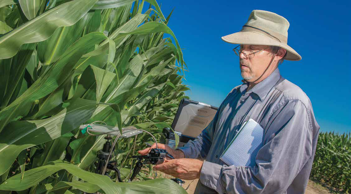
For instance, remote sensing research reports how a crop is growing and can detect problems early, before the human eye could. This could help producers reduce the amount of inputs, such as fertilizer and water, that they apply to crops.
In addition, remote sensing research could lead to the production of crops that are more efficient in combating heat and nutrient stress, allowing producers to save on input costs.
Remote Sensing Explained
When an object being viewed is too small or too far away, aircraft and satellite remote sensing instruments come into play.
“Remote sensing instruments can go far beyond what our eyes can see,” Gamon said. These instruments can be anything from a drone a few feet above Earth’s surface, to a satellite in Earth orbit. Without the evolution and development of remote sensing, many daily tasks, such as checking the weather forecast or mapping out a travel route, would be impossible, he said.
“Historically, remote sensing techniques have been used for military intelligence gathering,” Gamon said. In 2019, however, his research is focusing specifically on using a plane and/or satellite to conduct remote sensing research on vegetation. With the help of aircraft instruments, Gamon is able to look at an area of the Earth’s surface in a new way. He is able to observe and record the spectral reflectance and signature of the vegetation he is studying.
“Spectral reflectance is the amount of light being absorbed by or bouncing off an object,” Gamon said. “Every object identified through remote sensing will reflect its own unique spectral signature.”
By studying the spectral signatures of plants, Gamon is better able to understand the factors that affect plant growth and determine ways to improve growing conditions and more cost-effective, efficient application practices and plant varieties in general.
The unique spectral signatures help researchers tell the difference between land, water or vegetation. For instance, the spectral signature that a field of corn reflects would look different than the spectral signature of a lake.
The spectral signature data Gamon collects does not look like a regular geographic map or picture of the Earth’s surface. Gamon’s remote sensing instruments work to record an object’s spectral reflectance and translate its unique spectral signature onto a line graph or into false color images.
“Spectral signatures are sort of like fingerprints that tell us what kind of plant we're looking at or how healthy it might be,” Gamon said. “These aren't as perfect as the signatures of our fingers, and there's overlap in these signatures, but the patterns of reflected light allow us to infer a lot of information about the identity and function of the surface we're looking at, whether that's living or nonliving.”
In addition, a single plant’s signature can vary due to many different factors including the health of the plant, the rate at which it is photosynthesizing and even heat stress, he said.
Remote Sensing Development Projects
Gamon is currently involved in remote sensing research programs with several organizations: SpecNet, National Aeronautics and Space Administration (NASA), the National Science foundation, the European Space Agency, and the University of Nebraska–Lincoln.
SpecNet is a nonprofit organization that encourages the use of remote sensing, particularly for measuring vegetation, photosynthesis and productivity of plants. If plants are not being as productive as possible, Gamon and other researchers can compare the results to other areas of vegetation that are more productive.
The Arctic Boreal Vulnerability Experiment, or AboVE, is a NASA-funded project. Gamon leads an AboVE project and works with other researchers in the university system to study the effects of global change and climate variation on ecosystems.
The European Space Agency funds research at the Eastern Nebraska Research and Extension Center on vegetation photosynthesis and plant stress.
NASA and NSF support research in biodiversity detection and are leading to new ways to monitor changing biodiversity over large areas.
According to Gamon, the team tests new remote sensing equipment and techniques that can later be applied to the biodiversity monitoring and landscape level research in Nebraska and around the world — a technology that in the future, will help Nebraska researchers design ways to better maintain the state’s biodiversity.
“We don't really know the limits of what we can see and that’s what a lot of the work we do is, to try and understand that,” Gamon said.
The Center for Advanced Land Management Technologies, or CALMIT, is a University of Nebraska–Lincoln program that studies the use of remote sensing and other spatial technologies.
“The university has had a reputation for this work in remote sensing for quite a long time, which is one thing that attracted me to work with people at the university,” Gamon said.
A unique feature of the CALMIT is its airborne research program, which Gamon supervises. Gamon explained that CALMIT has a multiscale ability to do basic and applied research from the ground, and aircraft or satellites. A variety of methods is used to study the health and productivity of human-controlled vegetation and natural ecosystems.
According to Gamon, few, if any, universities in North America have the same capabilities as Nebraska and its CALMIT program.
Remote Sensing Research and Nebraska
Gamon said that remote sensing research can be used to design approaches more efficient in nutrient usage and application to avoid environmental damage to the state’s water quality and help Nebraska researchers implement better ways to maintain the state’s biodiversity.
“Biodiversity research today involves a range of approaches to understanding all the different kinds of life on the planet,” Gamon said. These approaches include looking at and measuring both species diversity and genetic diversity in Nebraska and elsewhere.
Species diversity is defined as the number of different species in a given place and how those species change and evolve across landscapes, according to Gamon. Whereas, genetic diversity measures how much variation in genetic composition exists in a landscape, and also functional diversity. These both can be studied using remote sensing.
Biodiversity provides resilience by itself. According to Gamon, this is a basic ecological principle. In other words, biodiverse ecosystems provide themselves with the capacity to solve their own problems and bounce back under stress.
“Plants reproduce in different ways. They function differently. So, having a diversity of functional types is actually quite important for resilience,” he said. This is what the CALMIT program is trying to provide the state of Nebraska: heat-resistant crops, healthy water quality and diverse environments that will be able to bounce back on their own.
While there are many benefits to remote sensing research, Gamon acknowledged that due to expanding agriculture in Nebraska, there is a decline in biodiversity.
However, with the improvements to Nebraska’s precision agriculture practices along with the university’s ability to monitor the state’s biodiversity through CALMIT, the field of remote sensing has the potential to vastly impact the monitoring of Nebraska’s agriculture and natural resources biodiversity.