Flying over a field at 60 miles per hour is a device collecting data about the way a crop reflects light. The device sends the data to cloud-based software that gives a farmer real-time information about the crop. With that information, a farmer is able to make management decisions such as how much water or nitrogen to apply to the crop.
Born is a new age of managing fields of crops with unmanned aerial systems (UAS), often referred to as drones.
Viewing crops from the air is not a new practice for farmers, but new technology may make it easier to gather more data from crops.
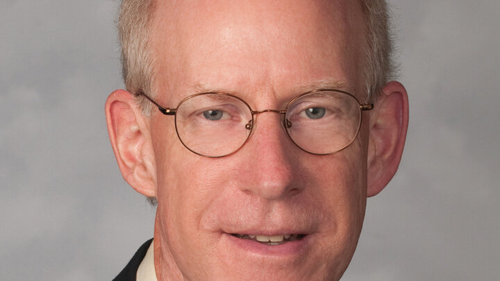
“There are three platforms farmers can use to view their crops from above: satellite imagery, manned aircraft and unmanned aerial systems,” according to Richard Ferguson, professor in the Department of Agronomy and Horticulture at the University of Nebraska–Lincoln.
“Although satellite imagery and manned aircraft have been in use for decades, drones are beginning to expand into the agriculture market,” Ferguson said. Unmanned aerial systems have the ability to provide rapid, and even real-time data to the farmer.
“Unmanned aerial systems have the advantage of being relatively spontaneous. A farmer can get a view of his field within five minutes of arriving at his field, and you really can’t do that with a manned aircraft or a satellite image,” Ferguson said.
According to Ferguson, unmanned aerial systems can not only help farmers view their fields but also can help optimize profits while minimizing environmental impacts, specifically with nitrogen fertilizer runoff and water usage.
“I have a broad interest in how farmers use geospatial information for assessing how their cropping systems perform and using that information for improved management,” Ferguson said. Geospatial information includes the location and geographic coordinates of a specific spot in
a field.
IMPROVED EFFICIENCY FOR MOISTURE AND NUTRIENTS
According to Ferguson, managing irrigated agriculture fields with a UAS can make the system more efficient.
“The UAS may be useful in assessing irrigated systems weekly and recording the areas where the field needs more or less water,” he said.
In addition to the water management, a similar flyover can detect areas in a crop field that need more nitrogen fertilizer. According to Ferguson, a farmer would then be able to apply water and nitrogen through the irrigation system on specific areas of the field. By gathering the data, a farmer would be able to take the guesswork out of irrigation and nutrient management.
One area of significant research is sensors, Ferguson said, by looking at crop reflectance characteristics and their reaction to a certain stress. The UAS is able to collect crop data by measuring reflectance that is generated from the crop.
“We’re looking at crop reflectance characteristics and trying to relate what the crop looks like and how it reflects during certain stress,” Ferguson said. To measure the crop reflectance, researchers must first measure how a crop reflects during normal circumstances – a reference for all other images or measurements. Once established, the UAS uses sensors to measure the light wavelength that is reflected from the crops.
“Sensors are continually evolving as are the technology and wavelengths that they can assess,” Ferguson said. “It’s a big area of research right now across our university.”
Ferguson’s area of research is nitrogen fertilizer and how different crops, hybrids and cultivars look to sensors in normal conditions.
“We will say ‘for this field, for this crop, for this area, we know is not stressed for nitrogen and it looks this way.’ And we will compare the rest of the field to that reference and say ‘relative to that, it has some change and reflectance and certain wavelengths and then we can relate that to whether it needs nitrogen fertilizer,” Ferguson explained. The same comparison might be made for other stresses, such as pests, he added, with comparisons made between the reference images and stressed images. Water stress, though, has unique reflectance in mid-infrared and thermal bands, leading scientists to quickly identify water as the stressor.
BIG CROP DATA
Right now, most sensors are image-based, Ferguson said. One kind of sensor is a “passive sensor” that uses the sun as a light source; then there are “active sensors” that have an internal light source. “Theoretically, we could collect information about every square meter, every second,” Ferguson said. But that would accrue millions of data points in a field every day, and that becomes a great deal of data very quickly – more than could be processed on a spreadsheet. Most unmanned aerial systems have onboard data storage for their sensors, but Ferguson said increasingly, that data may be linked to cloud-based systems.
A cellular modem or a satellite connection that loads data into a cloud-based server is needed so a farmer or a scientist can access the information anytime, anywhere, from any platform, Ferguson said. That is not commonly done with agriculturally oriented unmanned aerial systems, but Ferguson said he believes wireless transmission of data is in the future, going from the unmanned system to the ground, to a server for instant data processing.
LEGAL RESTRICTIONS
Ferguson said that using a UAS to observe crops requires Federal Aviation Administration (FAA) permits and certifications if the result of observing the crops leads to an economic benefit.
“If you want to manage your crop, that becomes a commercial enterprise, so you can’t just buy a UAS off the shelf and go out and fly it. To fly commercially, you need to have a remote operator’s license certification from the FAA, which requires passing a knowledge exam,” Ferguson said.
Beyond passing the exam, Ferguson said that the FAA has rules on the way a drone is flown.
“There are restrictions in terms of height; you can’t be over 400 feet above the ground. The UAS has to be within your line of sight while flying and you can only operate one at a time,” Ferguson said.
Because of the legal restrictions, Ferguson expects that some farmers will prefer to hire a company or person that has the certification to provide drone services. Additionally, Ferguson encourages farmers to try the technology out to see if it is a right fit for their operation.
“I encourage farmers and their advisers to not hesitate to try it out. It’s easy to do and can be an economic benefit for a farmer’s operation. Just be sure that you do it within regulatory considerations.”
